.jpg)
2026 HYDRIC SOILS - Part 2
This page contains links to resources for participants of the 2026 Hydric Soils for Wetland Determinations - Part 2 Course.
Disclaimer: Documents developed by the Illinois Soil Classifiers Association and other documents presented here, are from published and/or unpublished sources. Any recommendations contained herein are informational and may become dated as new research and information is developed. By acting upon, or otherwise utilizing any of this information, the user takes responsibility for any outcome and agrees to not hold ISCA, including its officers and committees, liable.
ISCA Presents - Hydric Soils for Wetland Delineation - Part 2
Co-Sponsors:
Illinois Soil Classifiers Association, Lake County Stormwater Management Commission (SMC), Lake County Forest Preserve District (LCFPD), DuPage County Stormwater Management, Engineering Resource Associates, V3 Companies, M&M Soils, LLC
Questions about content? Contact Webmaster@illinoissoils.org
Registration closed on 7/31. Contact Webmaster@illinoissoils.org for more information


*Downloads for Course and other references
*Field Indicators of Hydric Soils v9.3 (complete)
*Abbreviated Illinois Hydric Soil Indicators v9.3
*Redoximorphic Features for Identifying Aquic Conditions - NC State
*Field Guide for Measuring Percent Redox Coverage
*Soil Textural Triangle
*Soil Texture Flow ChartHydric Soils USDA NRCSIllinois On-Line Drainage Guide"Illinois Drainage Guide" Circular 1226, 1984 (archived pdf booklet for determining set-back distances) National Water & Climate Center
How Water Moves Through Soil - YouTube Video
2026 Class Presentations
ISCA Hydric Soil Field Trips & Seminars
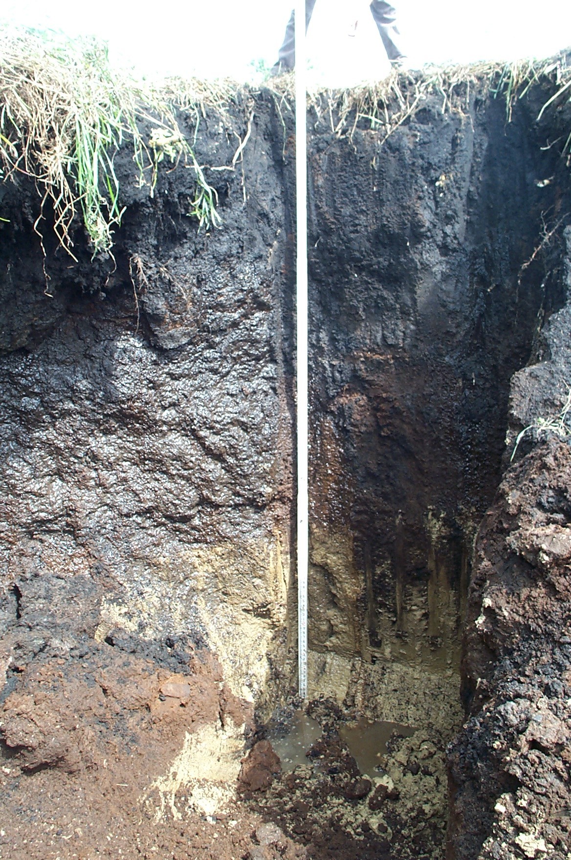
Muck over marl - 2023
After discussing this site and doing a bit of research, we concluded that the whitish layer is marl (Lma horizon) formed by near-shore lakebed sediments from a past environment. The marl was also enhanced by the accumulation of secondary carbonates which were discharged in the calcium-rich groundwater through the stratified soils. Marl is a kind of limnic material (freshwater lake sediment) that is high in calcium carbonate and generally feels chalky or silty.